
Aerial Site Survey
Bring your view to new levels
No matter the size of the project, monitoring progress and having direct access to up-to-date information of your site is vital.
Make better decisions and improve your efficiency with 3D mapping.
Why use drones?
Drones provide a cost-effective, unobtrusive and safe way of carrying out a range of services. Whether some simple photography or video capture is all you need to keep an eye on things, or full-scale mapping and digital reconstruction is required, we can help you.
- Cost-effective
- Precise
- Faster
- Safer
We work with the latest software to help you work smarter, not harder.
Capture
Capture your images using drones and handheld cameras
Process
Process your images on the cloud with ease.
Interpret
Track site progress by visualizing, monitoring and documenting it.
Integrate
Export your outputs to third-party CAD and BIM software for further steps.
*Completed on client request
What we can do
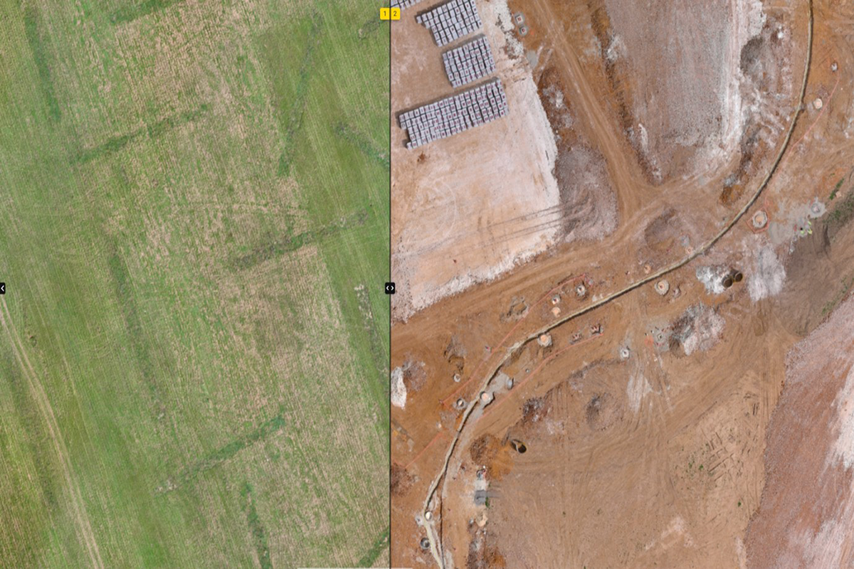
Monitor Progress
When a site is visited at regular intervals, the Pix4D software allows users to browse any capture date from the timeline, and compare any two dates with split-screen views.
- Fully insured
- Civil Aviation Authority Approved
- Precise
What we can do
Monitor Progress
When a site is visited at regular intervals, the Pix4D software allows users to browse any capture date from the timeline, and compare any two dates with split-screen views.
- Fully insured
- Civil Aviation Authority Approved
- Precise
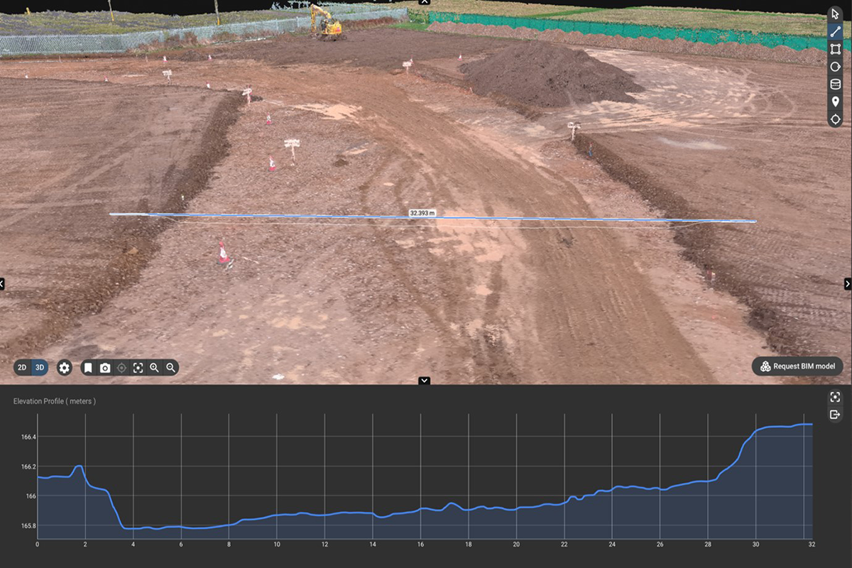
Photogrammetry
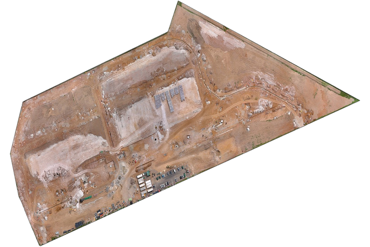
Using the powerful Pix4D Cloud photogrammetry software, complete and seamless orthomosaic (top down view akin to Google satellite view) of an entire site is possible regardless of size.
Complete 3D reconstructions are possible, allowing for fast and accurate measurements to be taken, including distance, size, depth, area or volume.
- Drone mapping
- Progress tracking
- Site Documentation
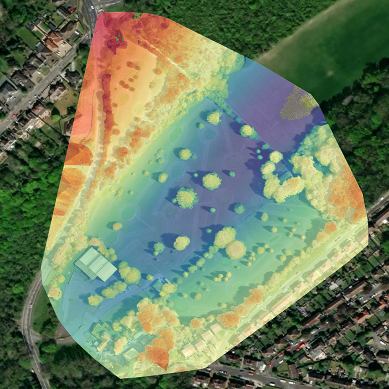
Digital Surface Models
You will be provided a link to access your site online, from which you can browse and start taking your own measurements. Alternatively, I can take measurements and make annotations for you, which will be visible on your links.
- Fast
- Safe
- Effective
Professional results every time
Precise results
Trust Aerial Imaging to get you the results you need
High quality content
Site surveys created using photogrammetry
*Aerial Imaging South East is not a surveying specialist
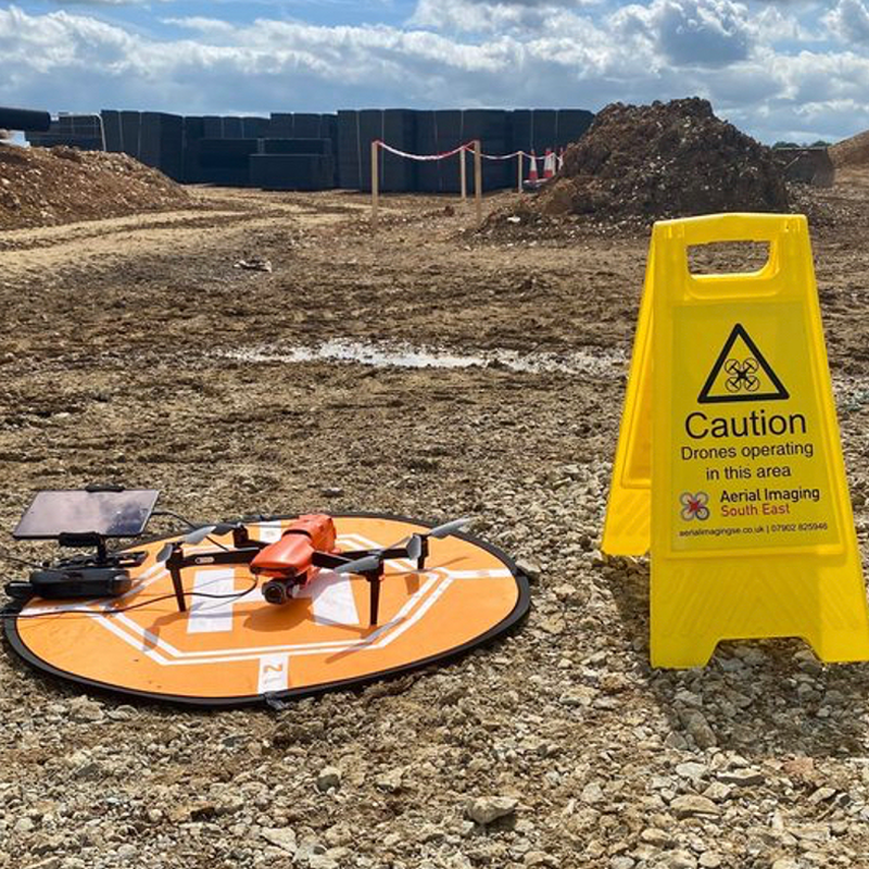
Safety First
Using my own CSCS cards and PPE allows basic access to most sites following an induction
FAQs
If you have any questions, why not read our FAQs. If we still haven’t answered your question feel free to contact us and we’d be happy to help.
A drone survey is an efficient and effective way to collect data and get an overview of an area.
Drones are becoming increasingly popular for surveying purposes due to their flexibility and ability to access difficult-to-reach places. A drone survey can cover a large area quickly and thoroughly, making it ideal for gathering information about a site before starting a project and during the course of the project.
Drone surveys conducted by Aerial Imaging South East have good relative accuracy.
The whole site is subject to normal GPS variance (+/- a few metres on any axis) but between any two points on the survey, accuracy is good. If higher absolute accuracy is required, the use of Ground Control Points or an RTK system is possible. All prices available on request
The latest technology enables drones to capture high-quality data that can be used to generate reliable results. This makes drone surveys an attractive option for many engineering and construction projects. For more information feel free to contact me.
Drone surveys normally start at £450, this is dependant on your requirements and a full quote can be available on request.
The majority of our work is pre-planned with all preparatory aspects completed ahead of our visit. This means that flight plans and parameters are mapped ahead of time allowing the drone to cover the area autonomously.
Most on site work can be completed in less than an hour. More complex surveys can take longer, but are usually no more than 3 hours. For more information please feel free to contact me.
Case study
FM Conway

Aerial Photography in Medway
FM Conway has been using drone technology to carry out aerial photography and monthly site surveys at one of our sites in Medway to showcase how we are improving efficiency and accuracy across our projects
5 Star Rated
Clients Testimonials
Thanks to our clients